Just wanted to share just a few ramblings about the system this weekend and why it’s not a total write off.
First off, I’m not surprised by any means that the models have continued to change. What is interesting, is they are not shifting back and forth, but a continuation of the southern shift every single run. A sign??
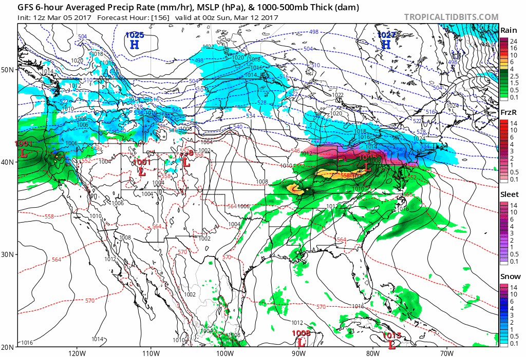
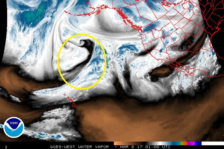
Again, the wave that will play a role in the development of this system is still way off shore and more changes are likely to occur, maybe it drops south more, maybe it shifts back north, anyone’s guess at this point.
The problems I see are the strength of the shortwave and the deep trough located in the Northeast. This Northeast trough plays a pretty big role in the overall flow. With this trough positioned as such, it creates a predominate northwest flow. This in turn affects the shortwave by not allowing the system to deepen, but rather further suppresses it and creates a weaker system overall.
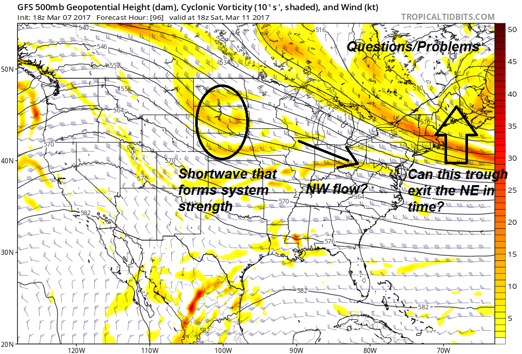
Why it’s not a miss. If we look further aloft at the jet stream, we notice a jet core that develops over the eastern Great Lakes. This is progged on both the GFS the European models, even shows up nicely on the ensembles.
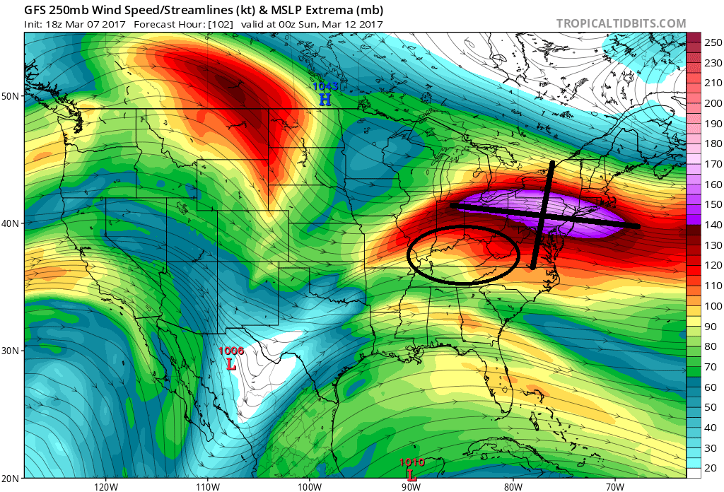
This very strong jet core will position the entrance region right over the Ohio Valley. This would allow for a rather large area of divergence and the possibility of making a large expansive shield of precipitation. But it’s important to keep in mind that this is only part of the equation. The other factor is the location of the cold front that this system is developing on.
Could this end up being a glorified clipper? Possible. Could it shift back north? Also possible. Either way you look at it, there is a system there.
What do I think? I don’t know exactly. If the trough in the Northeast can exit and the shortwave deepens, we have a pretty good shot for snow on the northern end. If it remains weak and the northwest flow remains in check, then its possible this system bypasses altogether. But with the jet core highlighted above, I’m not sold on it completely bypassing.
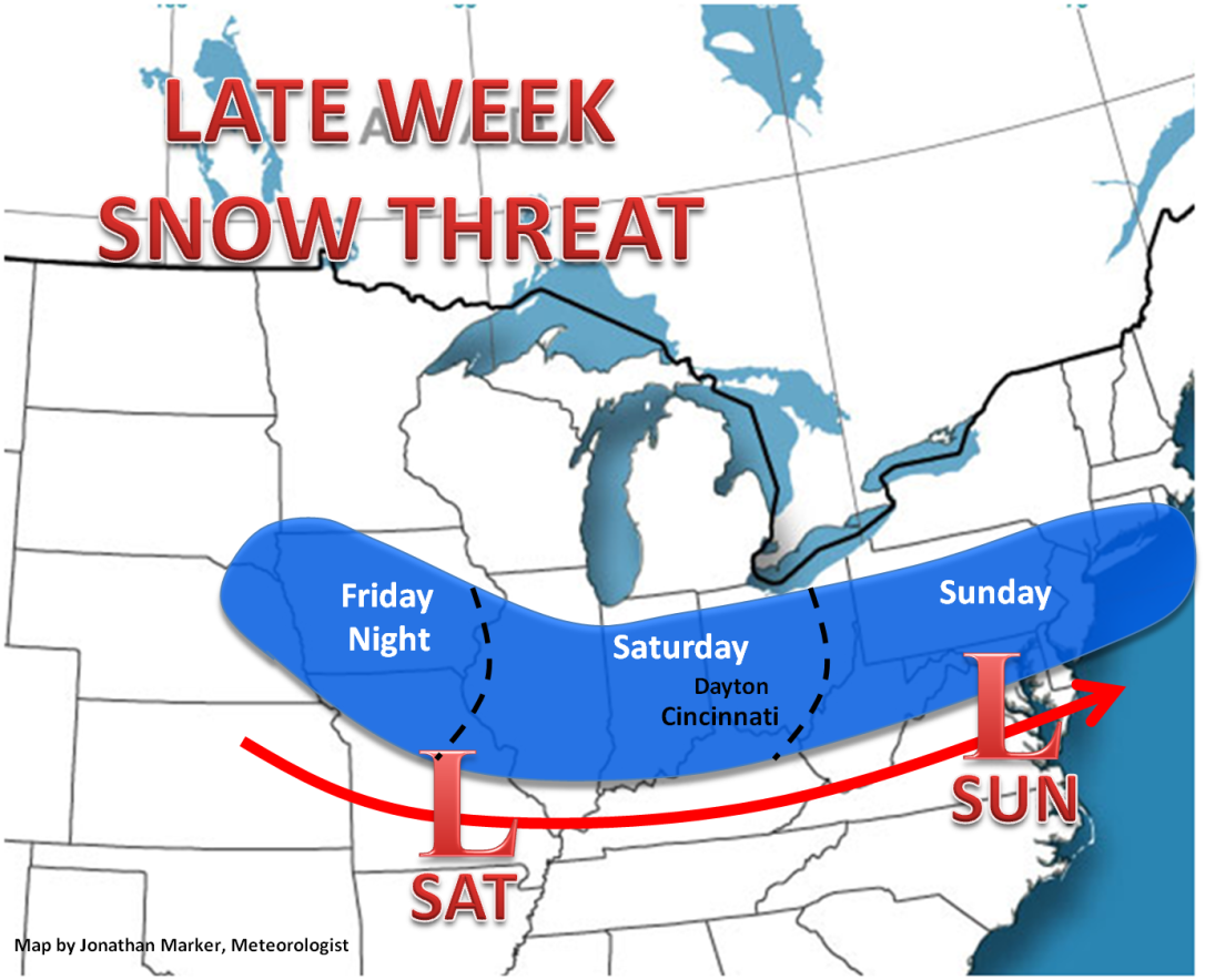
For now, I will keep the threat area in place, I think this system can only go so far south. Will make adjustments tomorrow.
The wonders of weather!
