
Rumors of a late week winter storm have made their rounds on social media as forecast models so the potential for a late week winter storm.
Needless to say, this winter has been quiet in terms of widespread and significant snowfall across the Ohio Valley. For the Dayton area, meteorological winter (December-February) has ranked 12th in least snowfall coming in with 7.2 inches.
Today two of the major forecast models have made a change, showing the threat for a winter storm during the Friday-Saturday time-frame. There is much uncertainty about this system, but there is enough information to highlight the threat for a wintry system this coming weekend.
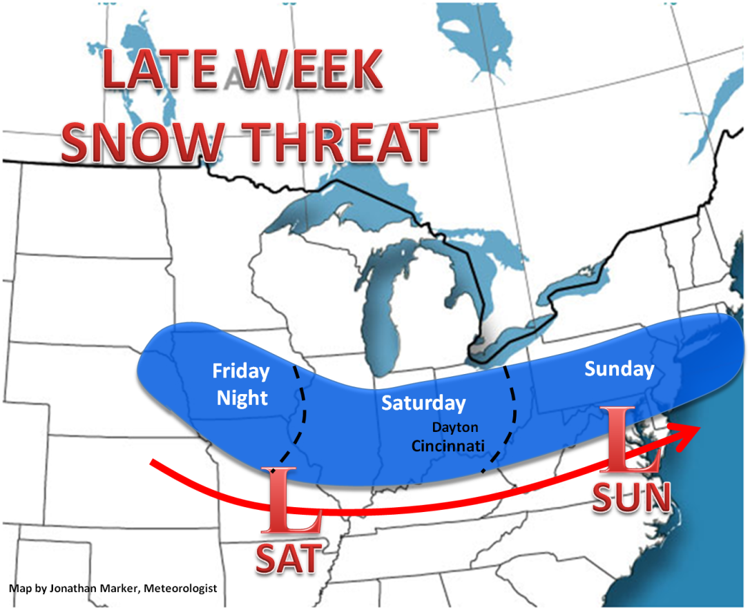
The energy for this particular system is located all the way out in the central Pacific Ocean near Hawaii. This gives lots of uncertainty in the forecast because models will continue to change the strength and track of this system, thus the precipitation type. Until the models are able to observe this system clearer in the coming days, it will remain impossible to nail down specifics (e.g., amounts) this far in advance.

The bottom line, there is the threat for a storm system late week that has the potential to bring snow to the Ohio Valley. The details will continue to evolve once the system begins to move towards the West Coast of the United States by Thursday.
Stay tuned for updates!
-Jon.
